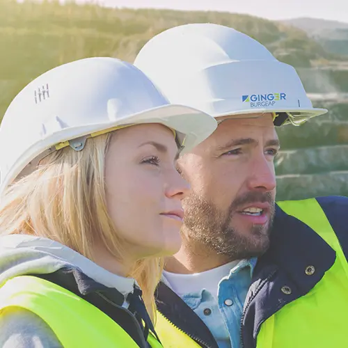
The platform for soil survey
With TerraIndex, you can enter field data digitally on site, instantly generate borehole logs, and easily create lab orders. Receive analysis results digitally, validate them against local laws and regulations, and effortlessly generate a complete, professional report.
Explore the features below!

Fieldwork preparation
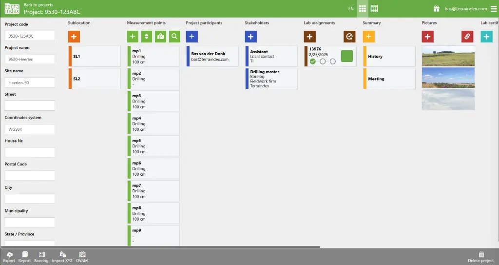
Everything in one place
Before heading into the field, you can prepare all your data in TerraIndex, such as planned drilling locations (accessible on the map) and fieldwork documents. This way, everything is digitally available on site, while the office always works with the same information. This prevents errors and improves communication.
Fieldwork
The intuitive fieldwork app
In the field, you can easily get started with TerraIndex using a tablet. Our fieldwork app is tailored for soil investigation and developed in collaboration with fieldworkers. This makes it extremely easy to use and perfectly aligned with your needs.
The fieldwork app can be used on almost any tablet and operating system.
Fieldwork
Seamless communication between field and office
The fieldwork app is directly connected to the web version used in the office, containing exactly the same information. This ensures everyone works with the same data. When you run into something in the field, you can instantly share your data (such as borehole locations on the map, or even complete bore logs), making communication with colleagues at the office much easier.
Fieldwork
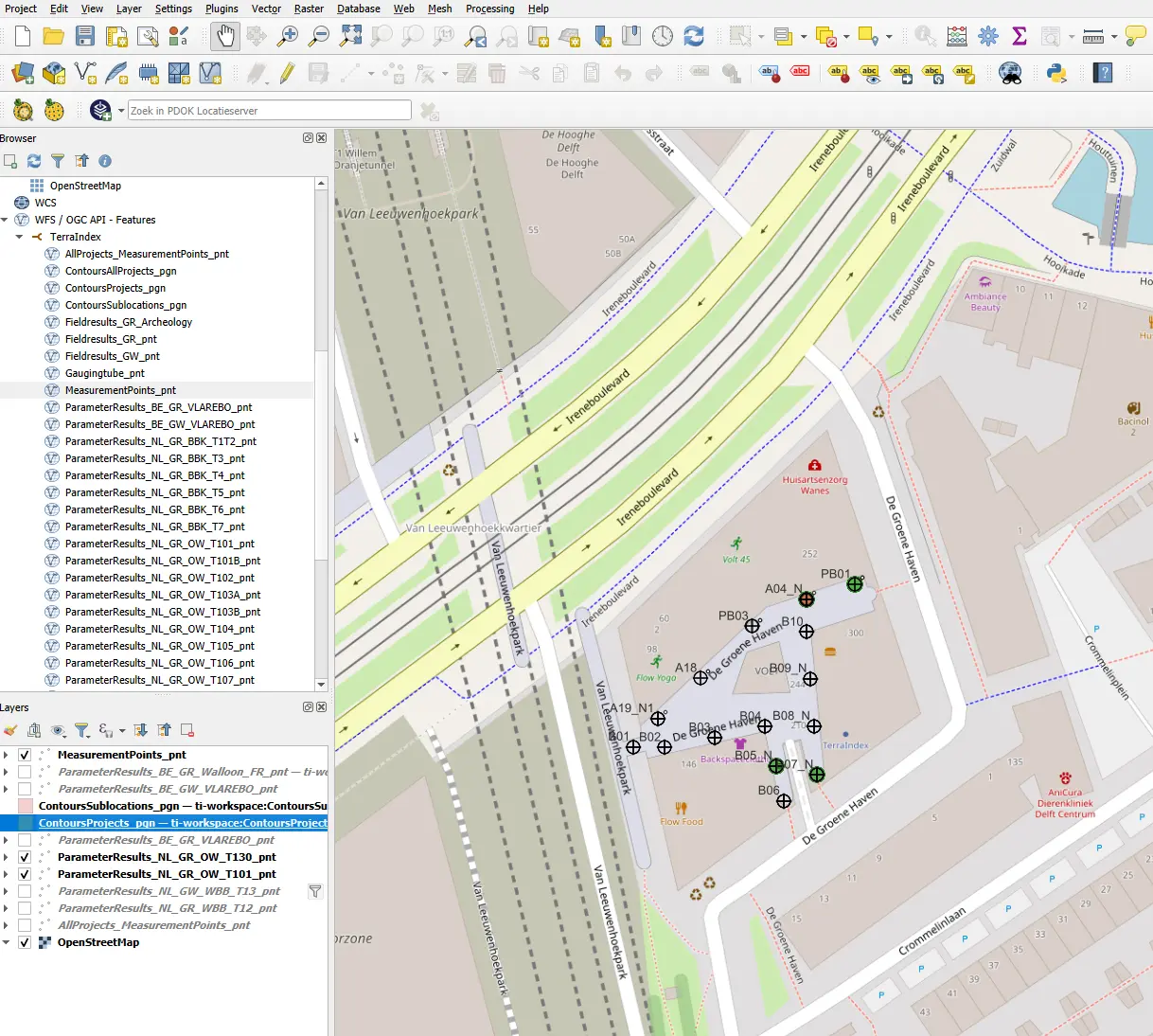
Real-time mapping
With TerraIndex’s mapping function, you can easily open drilling plans, notifications, and other map layers. TerraIndex offers a variety of base maps. Using the GPS function, you can precisely measure and plot your drillings with the correct coordinates directly on the map.
Fieldwork
Enter data
In the field, you can easily record at each measurement point who performed the drilling, how it was done, the soil layers encountered, whether a monitoring well was installed, which samples were taken, and if there are any special observations. This also includes PID measurements, oil-water reactions, and specific components. The app is highly intuitive and easy to use.
Fieldwork
Scan samples
Samples (jars, buckets, bottles, containers, etc.) are labeled with a barcode. These can be easily scanned via the app, instantly linking the correct samples to the correct soil layer.
The laboratory, connected to TerraIndex through an integration, immediately receives the right data matched to the right soil layers.
All major laboratories work with TerraIndex.
Fieldwork
Clear overview
With the “Daily totals” overview, you can instantly see what still needs to be done and whether any data is missing. This prevents you from having to return to a location because drillings or samples were forgotten.

Fieldwork and reporting
Generate borehole logs
With just one click, you can generate the borehole logs of your project. Since all data is entered digitally, logs can be created instantly and easily. Several templates are available, which can also be customized to your preferences, allowing you to create your own “standard” templates. Borehole logs can be generated both in the field and at the office.
Fieldwork and reporting
Photos and documents
With TerraIndex, you can easily take photos of the site using the camera of your device. These photos can be taken at both the project level and the measurement point level. You can also add other documents to the project. This way, the office instantly has all the information, which can then be seamlessly added as appendices to a report if needed.
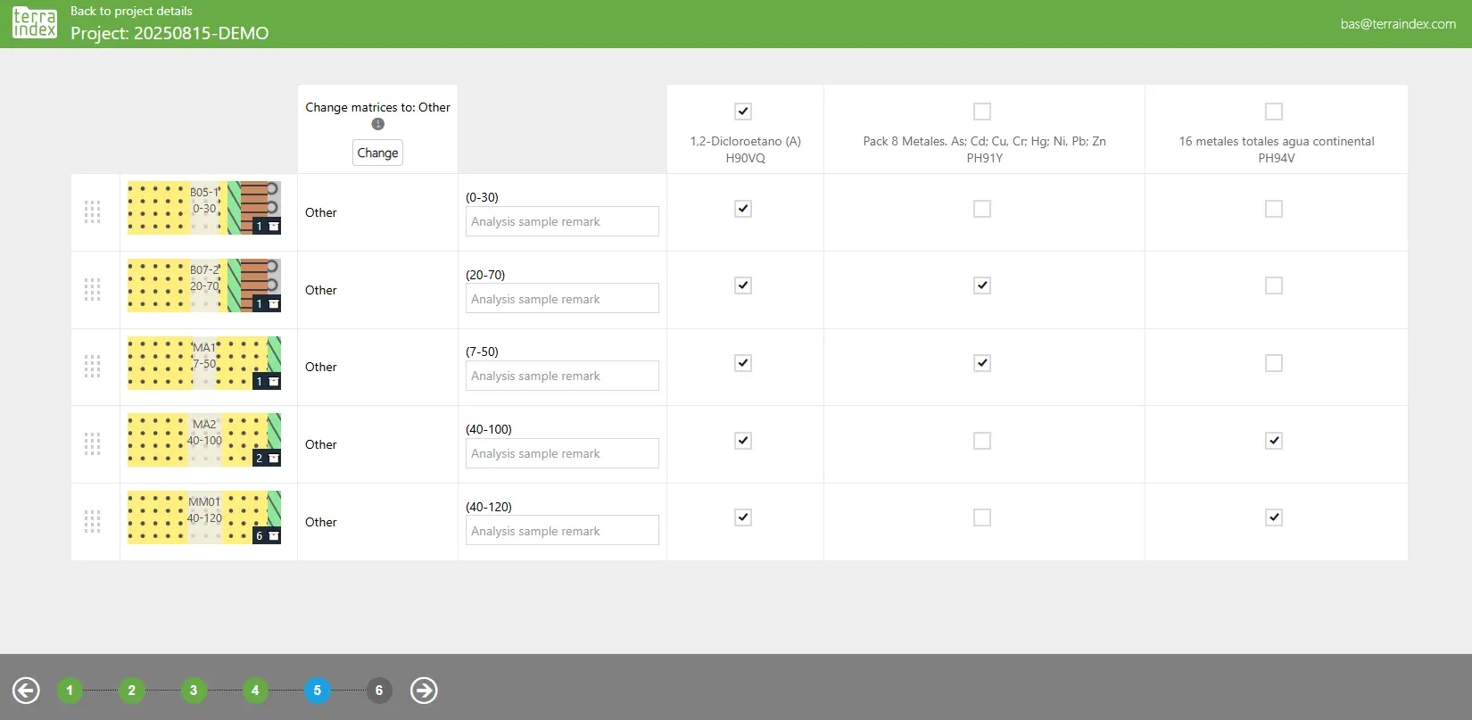
Lab order
Easily create a lab order
Creating a lab order is quick and easy. Since all major laboratories are connected to TerraIndex, you simply select which soil layers you want to analyze in a (composite) sample. You then specify what parameters the layers should be analyzed for. Additional details, such as urgent deadlines, can also be added.
Validate and analyze data
Instantly validate analysis results against the right regulations
Once the laboratory has analyzed the samples, the results are immediately available in TerraIndex. With a single click, these results are checked against the relevant local laws and regulations and presented to you in a clear report. This way, you instantly know the situation.
Report and export
Report your data
With just one click, you can export your data into your preferred format. A wide variety of reports are available. You can also define your own standard report templates, ensuring your data is always reported exactly the way you want it.
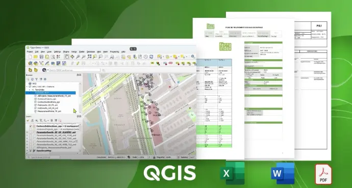
The Geoserver
Link your GIS through the Geoserver to the data in TerraIndex, enabling you to create geographical visualizations from this information.
Report and export
Export options
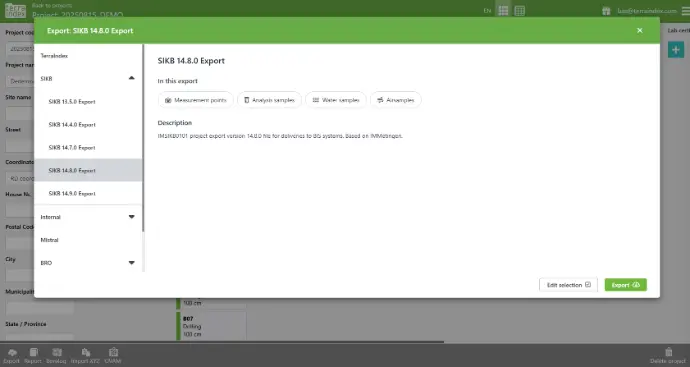
You can export your data in various formats, such as XML, DOC, and SIKB. This makes it easy to integrate TerraIndex with other systems.
Software
Available languages
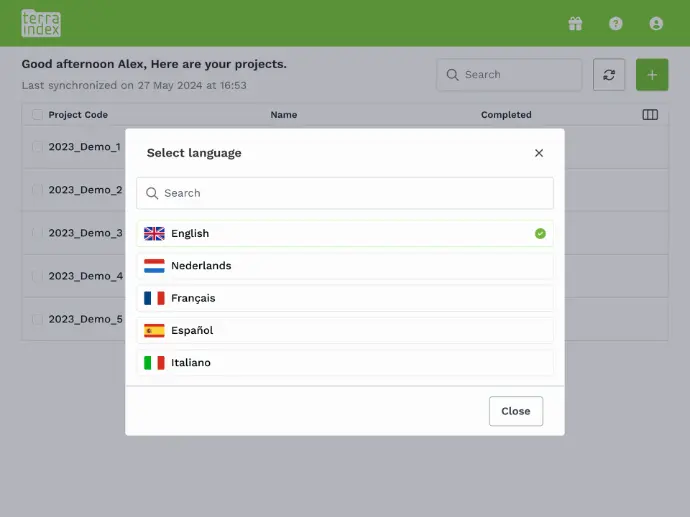
The software is currently available in English, Spanish, French, Italian, and Dutch, and is tailored to the Dutch, Belgian, French, and Spanish markets.
OUR PARTNERS
Collaborating for quality
The quality of soil research is highly dependent on the collaboration between the various chains within the research process.
We share our knowledge and expertise with various industry organizations, knowledge centers, laboratories, and other partners who are involved or benefit from qualitative soil research. Together, we ensure greater safety and reduced risks in the execution of construction and infrastructure projects.


" With TerraIndex, the process can be organized smarter and more efficiently, delivering significant benefits in terms of quality and time savings. "
" The user interface of TerraIndex is simple. This makes using TerraIndex very easy and intuitive. "

" Among younger colleagues, TerraIndex is even compared to the PlayStation for fieldwork. "
" Since we started using TerraIndex, we’ve been saving a huge amount of time. "

" TerraIndex continuously improves its software and carefully listens to its customers’ needs. "

Discover TerraIndex with a free demo
Request a no-obligation consultation and live demo with one of our experts. After registration you will receive a confirmation with the login details.
Get to know TerraIndex and our process
Receive free advice
Request A Demo
The conversation and demo lasts ± 90 minutes and three people can participate.